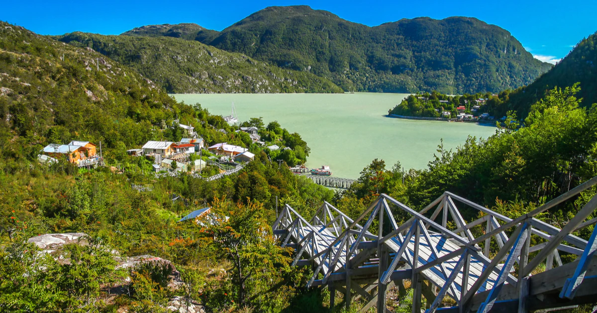
The End of the Road: Cochrane, Tortel and Villa O'Higgins
The last 400 km of the Carretera Austral, from the Baker river to the sign at Puerto Bahamóndez, and how to plan it with a camper.
Few travellers make it south of Cochrane. The ones who do get the emptiest and wildest part of the Carretera Austral: the Baker river, the boardwalk village of Caleta Tortel and the lake at Villa O'Higgins, where the road finally stops.
This route picks up where the Lake General Carrera loop leaves off, at Puerto Bertrand. From the end you either drive back north, or take the Crux Australis ferry to Puerto Natales and carry on to Torres del Paine without leaving Chile.
⛽ Fuel is the rule down here. Fill up in Cochrane every time you pass through, and carry what you need for the round trip to Tortel and to Villa O'Higgins. Between those towns there's nowhere to buy fuel.
Day by day
Along the Baker, past the confluence
The road follows the Baker, the biggest river in Chile, all the way to Cochrane. About 12 km out of Puerto Bertrand, a short trail leads to the viewpoint where the turquoise Baker meets the grey Neff. As of late 2026 there's paving work between the confluence and the Chacabuco bridge, so expect stops and dust.
Cochrane is the last real town in the south: fuel, supermarkets, mechanics and places to eat. Use it as your base for two or three nights.
Guanacos, the old estancia and the museum
Turn east onto the X-83, 17 km north of Cochrane. The Chacabuco valley used to be a huge sheep ranch. It was bought for conservation in 2004, cleared of fences and livestock, and is now part of Patagonia National Park. You'll see guanacos by the road and condors overhead.
At the visitor centre, the museum tells the story of the rewilding. The La Confluencia trail (3 km) is an easy walk; Lagunas Altas (21 km) fills a whole day. The park doesn't allow fires or camping stoves, so bring a cold lunch.
Down the Baker to the sea
Narrow gravel with few places to stop. Look out for Lago Esmeralda 7 km south of Cochrane and the El Salto falls a little further on. At El Vagabundo, the X-904 branches off for the last 22 km to Tortel.
Cars stop at the top of the village. Tortel has no streets, only more than 8 km of cypress boardwalks and stairs down to the water, so you'll leave the camper in the car park and explore on foot. Wear good shoes: the wood gets slippery in the rain, and it rains a lot.
A boat to the Jorge Montt glacier, or the Isla de los Muertos
The full-day boat trip to the Jorge Montt glacier, at the northern tip of the Southern Ice Field, takes 5 to 7 hours. The shorter trip to the Isla de los Muertos, an old cemetery on the Baker delta from the years of the first settlers, takes 2 to 3 hours. Both depend on the weather. For a free view, climb to the Cerro Vigía lookout over the village and the river mouth.
The Mitchell fjord barge and the last 90 km
From Tortel, drive 44 km to Puerto Yungay. The free barge across the Mitchell fjord to Río Bravo carries about 12 vehicles, first come, first served. In summer it leaves roughly every hour, less often the rest of the year. Check the schedule the day before and get there early.
From Río Bravo it's 90 km of gravel through forest and past lakes to Villa O'Higgins. Lago Cisnes, 11 km before town, has a beach that's lovely for a stop.
The O'Higgins glacier and the real end of the road
The road continues 7 km past the village to Puerto Bahamóndez, where the sign marks the end of the Carretera Austral. From here, boats cross Lake O'Higgins to a 70-metre wall of ice. Departures are on scheduled dates, weather permitting, with a minimum number of passengers, so book as soon as you know your dates. A shorter outing is the Río Mosco valley viewpoint, 3 to 4 hours return from town.
Stay at least two nights. Driving 1,200 km to turn around the same afternoon would be a shame.
Getting back
There are two ways out. The first is to drive north the way you came, which is about two long days to Coyhaique. The second is to drive back to Puerto Yungay and board the Crux Australis, which spends about 41 to 44 hours sailing the channels to Puerto Natales. Our Nomad Campers can go on board, and we offer one-way trips that end in Punta Arenas, so you can finish the trip at Torres del Paine.
Trekkers sometimes cross into Argentina from Villa O'Higgins on foot or by bike, by boat and trail to El Chaltén. That route isn't open to vehicles. Neither is the Paso Mayer track south of the village, which needs river crossings and is only passable for 4×4s at low water. Don't plan on it with a camper.
People also ask
Is the Carretera Austral south of Cochrane paved?
Almost all of it is gravel, with short paved sections near towns. It's passable in a normal car in good weather. A 4×4 camper makes it easier and safer, especially after rain.
Do I need to book the Puerto Yungay barge?
No. It's free and works first come, first served. Arrive early in summer, since only about 12 vehicles fit on each crossing.
Can I drive a camper into Caleta Tortel?
To the top of the village, yes. There's parking where the road ends, and the village itself is boardwalks only, so you visit on foot.
How many days from Coyhaique to Villa O'Higgins?
It's about 560 km, and you can drive it in three days, but it's better done in six to eight with stops at Lake General Carrera, Cochrane and Tortel.

Going all the way?
Tell us your dates. We'll help you time the barge, the glacier boats and the ferry south, so the end of the road doesn't end your trip.